


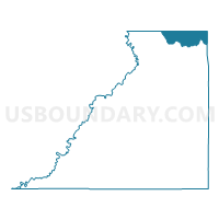
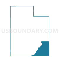
Spanish Valley Voting District, San Juan County, Utah
About
Outline

Summary
| Unique Area Identifier | 679872 |
| Name | Spanish Valley Voting District |
| County | San Juan County |
| State | Utah |
| Area (square miles) | 225.45 |
| Land Area (square miles) | 225.43 |
| Water Area (square miles) | 0.02 |
| % of Land Area | 99.99 |
| % of Water Area | 0.01 |
| Latitude of the Internal Point | 38.43705810 |
| Longtitude of the Internal Point | -109.31454230 |
Maps

Graphs
Select a template below for downloading or customizing gragh for Spanish Valley Voting District, San Juan County, Utah


Neighbors
Neighoring Voting District (by Name) Neighboring Voting District on the Map
- Castle Valley Voting District, Grand County, UT
- La Sal Voting District, San Juan County, UT
- Mesa 35, Mesa County, CO
- Moab 02 Voting District, Grand County, UT
- Moab 03 Voting District, Grand County, UT
- Moab 11 Voting District, Grand County, UT
- Montrose 10, Montrose County, CO
Top 10 Neighboring County Subdivision (by Population) Neighboring County Subdivision on the Map
- Moab CCD, Grand County, UT (9,098)
- Monticello CCD, San Juan County, UT (3,773)
- Nucla CCD, Montrose County, CO (2,749)
- Glade Park-Gateway CCD, Mesa County, CO (2,187)
Top 10 Neighboring Place (by Population) Neighboring Place on the Map
Top 10 Neighboring Unified School District (by Population) Neighboring Unified School District on the Map
- Mesa County Valley School District 51, CO (143,321)
- San Juan School District, UT (14,746)
- Grand School District, UT (9,225)
- West End School District RE-2, CO (2,123)
Top 10 Neighboring State Legislative District Lower Chamber (by Population) Neighboring State Legislative District Lower Chamber on the Map
- State House District 54, CO (86,291)
- State House District 58, CO (78,435)
- State House District 55, UT (38,435)
- State House District 69, UT (31,813)
Top 10 Neighboring State Legislative District Upper Chamber (by Population) Neighboring State Legislative District Upper Chamber on the Map
- State Senate District 7, CO (152,044)
- State Senate District 6, CO (144,787)
- State Senate District 27, UT (93,972)
Top 10 Neighboring 111th Congressional District (by Population) Neighboring 111th Congressional District on the Map
Top 10 Neighboring Census Tract (by Population) Neighboring Census Tract on the Map
- Census Tract 19, Mesa County, CO (5,089)
- Census Tract 3, Grand County, UT (4,833)
- Census Tract 9781, San Juan County, UT (3,773)
- Census Tract 9661, Montrose County, CO (2,749)